What the 1933 Long Beach Earthquake Built – 93 Years Later

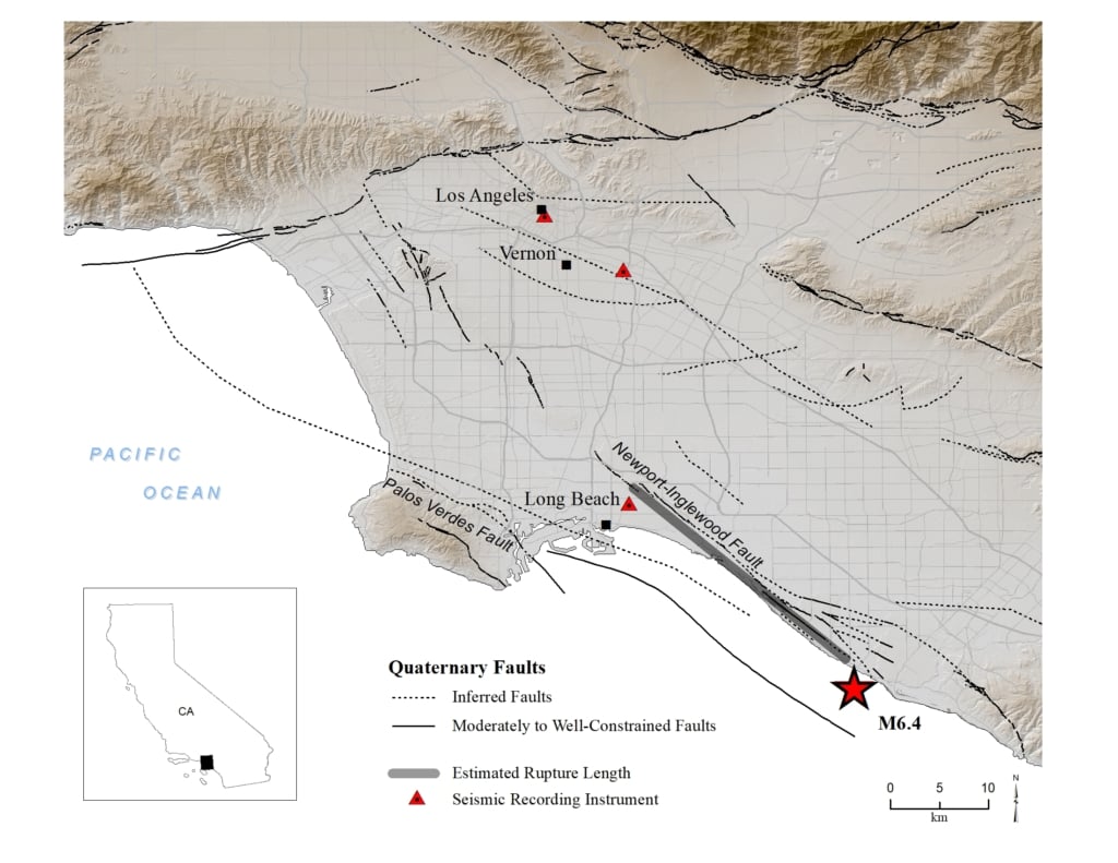
Ninety-three years ago today, at 5:54 p.m. on a Friday, a magnitude 6.4 earthquake struck near Huntington Beach and tore through the communities of Long Beach and Compton. It killed approximately 120 people, leveled or damaged 20,000 homes, and collapsed or seriously damaged more than 230 school buildings.
It also changed California — and eventually the country — in ways that are still visible today.
The Timing That Saved Hundreds of Lives
The 1933 Long Beach earthquake struck late on a Friday afternoon, during dinner hour. School had been out for hours.
That timing matters. When investigators surveyed the damage, the scale of school building failures was almost incomprehensible. Auditoriums had pancaked. Facades had sheared off. Exit paths were blocked by rubble. Had the earthquake struck three hours earlier, during a normal school day, the casualties would have been catastrophic.
The children survived by luck. What came next was something more durable.
Charles Richter Heads Into the Field
Among those responding in the immediate aftermath was a young Caltech seismologist named Charles Richter. He packed portable instruments and headed to the field alongside colleagues Harry Oscar Wood and Romeo Martel to document what had happened.
In his own words, he later described the event as “a very fortunate opportunity. We got into the field … with portable instruments and established some of the major facts about that earthquake as an event.”
The 1933 earthquake represented one of the first opportunities for Caltech’s seismological network — then only seven stations strong — to capture and study a major Southern California event in real time. Two years later, Richter and colleague Beno Gutenberg published the logarithmic magnitude scale that would bear Richter’s name and become the global standard for measuring earthquake size.
The science of earthquake understanding in America grew directly from the fieldwork done in the weeks after this earthquake.
What the Field Act Built
The political response was equally significant.
Within 30 days of the earthquake, California’s legislature passed and the governor signed the Field Act — named for Assemblyman Donald Field — which imposed strict construction standards and mandatory seismic inspections on all public school buildings in California. It was among the first laws in the United States to mandate earthquake-resistant construction.
It was also remarkably effective.
The first real test came in the 1940 Imperial Valley earthquake, a M6.9 event larger than Long Beach. Schools built before the Field Act suffered damage equal to 29% of their valuation. Schools built to Field Act standards suffered less than 1%.
Then came Sylmar in 1971. Northridge in 1994. Hundreds of schools in the shaking zone. Not one built to Field Act standards collapsed.
In the 93 years since a Friday afternoon earthquake destroyed more than 230 school buildings, zero schools built to Field Act standards have collapsed in an earthquake.
That is what protective action, built into systems before a disaster, actually accomplishes.
What 1933 Still Teaches
The Newport-Inglewood fault had been largely discounted before 1933. The scientific consensus at the time was that California’s seismic risk was concentrated on the San Andreas. This earthquake ended that assumption. It revealed that the Los Angeles basin sat above a network of active faults — and that organizations and governments operating in the region needed to prepare accordingly.
That lesson has continued to compound. The fault systems underneath Southern California, the Pacific Northwest, and much of the U.S. West Coast remain active. The question for any organization operating in these regions isn’t whether a damaging earthquake will occur. It’s what systems and protocols will be in place when one does.
The Field Act answered that question for school construction. It showed that when protective measures are engineered in advance — not improvised after the fact — they work.
The Same Principle, Applied to Time
Modern earthquake early warning systems operate on the same foundational logic: build the protection into the infrastructure before it’s needed.
ShakeAlert, the USGS-operated early warning network that now serves California, Oregon, and Washington, detects the fast-moving initial seismic wave and distributes alerts before destructive shaking arrives. Those seconds — sometimes as few as five, sometimes as many as sixty depending on distance from the epicenter — are enough time to halt surgical procedures, stop elevators, open fire station doors, shut gas valves, and get people into protective position.
The parallel to 1933 is direct. The Field Act didn’t stop earthquakes. It engineered the built environment so that when earthquakes happen, the consequences are different. Early warning doesn’t stop earthquakes either. It gives organizations the seconds they need for protection to be the outcome rather than the aftermath.
Richter called the 1933 earthquake “a very fortunate opportunity.” The science that came from it, and the legislation that followed it, have protected millions of people in the decades since.
The technology exists today to extend that protection further. The question — as it was in 1933 — is whether organizations will act before the next event, or respond to it.
Early Warning Labs is a commercial provider of earthquake early warning systems in the United States and an official USGS ShakeAlert partner. Learn more about how EEW protects people and facilities at earlywarninglabs.com.
SOURCES
- Caltech SCEDC: Long Beach Earthquake (1933)
- USGS: M6.4 March 10, 1933 Long Beach, California Earthquake
- Strauss & Allen (2016): Benefits and Costs of Earthquake Early Warning, Seismological Research Letters
- Charles F. Richter Oral History, Caltech Archives: digital.archives.caltech.edu
- California Conservation Blog: 1933 Long Beach Earthquake Photo Lookback
- Strong Tie Blog: 90 Years Later — How the Long Beach Earthquake Changed California’s Approach to School Construction
About EWL
Early Warning Labs (EWL) has partnered with the USGS to develop a powerful technology, that gives people time to take cover and creates automated responses for businesses, transportation & machinery to prevent massive damage.