
Updates, Resources, and Early Warning Labs in the News
See where Early Warning Labs has been covered in the press, learn about recent installations protecting organizations like yours, and find the resources you need to understand effective emergency preparation and early warning technology.

Earthquake early warning for airports: what California’s study and Cal OES funding show
A Cal OES-funded study put benefit-cost ratios on earthquake early warning at LAX and Palm Springs. Here's what it found, how the state airport grant worked, and where airports should start.

What Is an Earthquake Early Warning System?
An earthquake early warning system can give people and facilities seconds of notice before strong shaking. Here's how it works and how buildings use it.
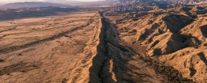
The San Andreas just hit its highest stress level in 1,000 years. Here’s what that means for facilities in Southern California.
A new study from the University of Hawaiʻi at Mānoa found that tectonic stress along the San Andreas and San Jacinto fault systems in Southern California [...]
The new head of ShakeAlert spent 30 years studying earthquakes in Alaska. Here’s what she’s focused on now.
Dr. Natalia Ruppert left Alaska after 30 years of seismology to lead the USGS ShakeAlert program. Her focus on automated facility response signals where earthquake early warning is headed.

Schools are setting safety plans for fall. Most still don’t have earthquake early warning connected.
School districts across California, Oregon, and Washington finalize their safety plans over the summer. Budgets get approved and emergency binders get updated. By August, the plan [...]

New research shows the Cascadia and San Andreas faults could rupture together. Here’s what that means for your facility.
Oregon State University research found the Cascadia subduction zone and San Andreas fault have ruptured together at least three times in 1,500 years. Here's what that means for facility operators on the West Coast.